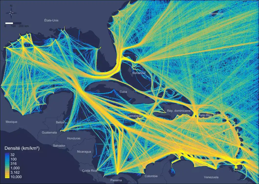
Spatial and temporal characterisation of maritime transportation (cargo, tanker and passenger) based on archived AIS (Automatic Identification System) data analysis.
More
[Geography] [Geomatics] [Marine environment]
Services and expertise in geography and geomatics specialised in maritime spatial planning.
More informationAbout Us
Geomatics
Geo4Seas is a design office specialised in the production, analysis, modelling and representation of geographic information for the sustainable development of territories and resources.
With more than 14 years of experience, we have developed a solid expertise in geomatics and geography, enabling us to provide solutions to industrials, public operators (managers of sensitive natural spaces, local authorities, government services), professional organisations and environmental consultancies.
Maritime Planning and Management
Describing, analysing and understanding the complex interactions between human activities and ecosystems are major challenges for maritime and coastal areas planning and management.
Geo4Seas offers a range of geomatics solutions that provide a realistic and dynamic knowledge of the spatio-temporal distribution of maritime activities, their potential interactions with each other and their multiple effects on the environment.
In partnership with the research community, Geo4Seas contributes to the modelling of the marine and coastal socio-system in order to assist in planning and management.
We assist you within your geomatics projects.
Geo4Seas provides operational solutions covering the acquisition, analysis and representation of geographic information.
Data acquisition and processing
Data acquisition from surveys.
Acquisition and pre-processing of AIS data (Big Data).
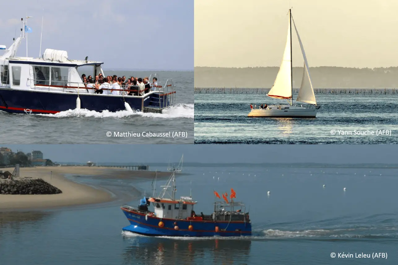
Acquisition of data related to maritime leisure activities.
Spatio-temporal and multicriteria analyses for the production of indicators
Human activities dynamics.
Interactions between activities / Use conflicts for space.
Interactions between activities and the environment (cumulative pressures/effects).
Mapping and interactive (Geo)visualizations
Mapping on multiple informative levels.
Dynamic and temporal mapping.
Our Services
Identification of fishing zones and characterisation of the fishing intensity based on heterogeneous data (regulatory zoning, key-informants’data, AIS, landings data, etc…).
MoreSpatialization and quantification of leisure activities distibution in the coastal zone based on heterogeneous data (regulatory zoning, key-informants’data, count data, etc…).
MoreCharacterization of uses conflicts related to space by taking acount spatio-temporal interactions between activities.
MoreAssessment of pressures and cumulative impacts induced by human activities on natural marine and coastal environments.
MoreSpatial optimization analyses in the framework of Systematic Conservation Planning (SCP).
MoreIdentification of potential facility sites that minimize interactions with other activities and pressures on ecosystem components (R&D).
MoreOur Skills
We are skilled in a wide range of tools dedicated to geomatics and specific to human geography.
We favour a reproducible approach by privileging the use of free and open source softwares. Depending on your needs, we also propose solutions via proprietary software.
Our projects
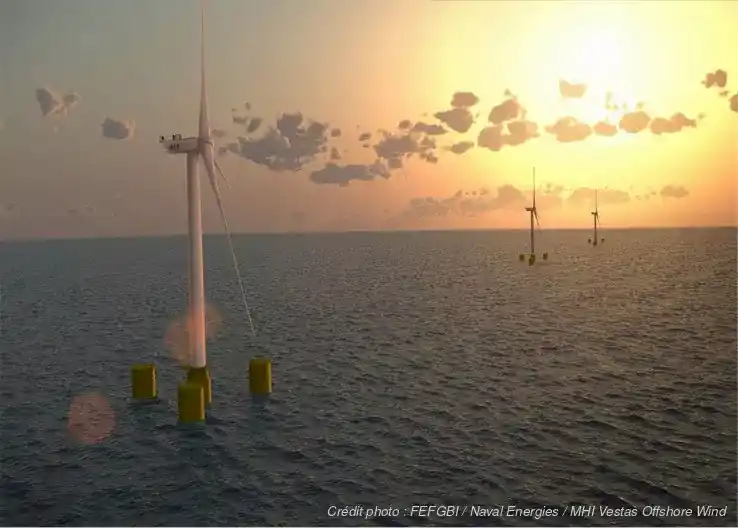
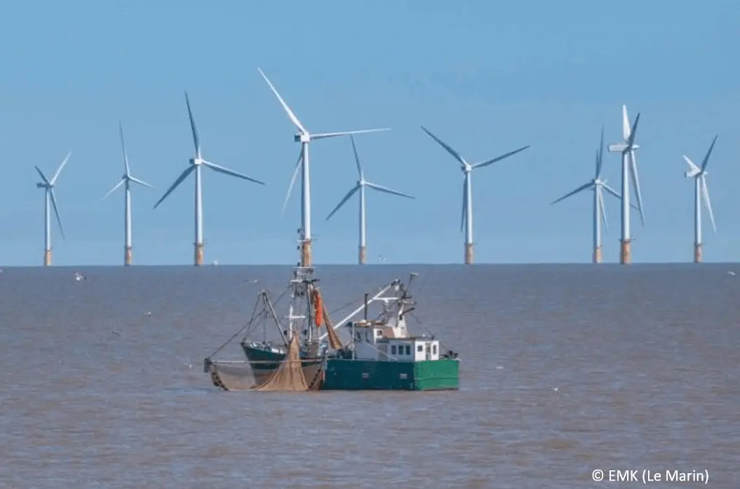
APPEAL
aims to identify and measure the ecological and socio-economic challenges related to MRE projects.
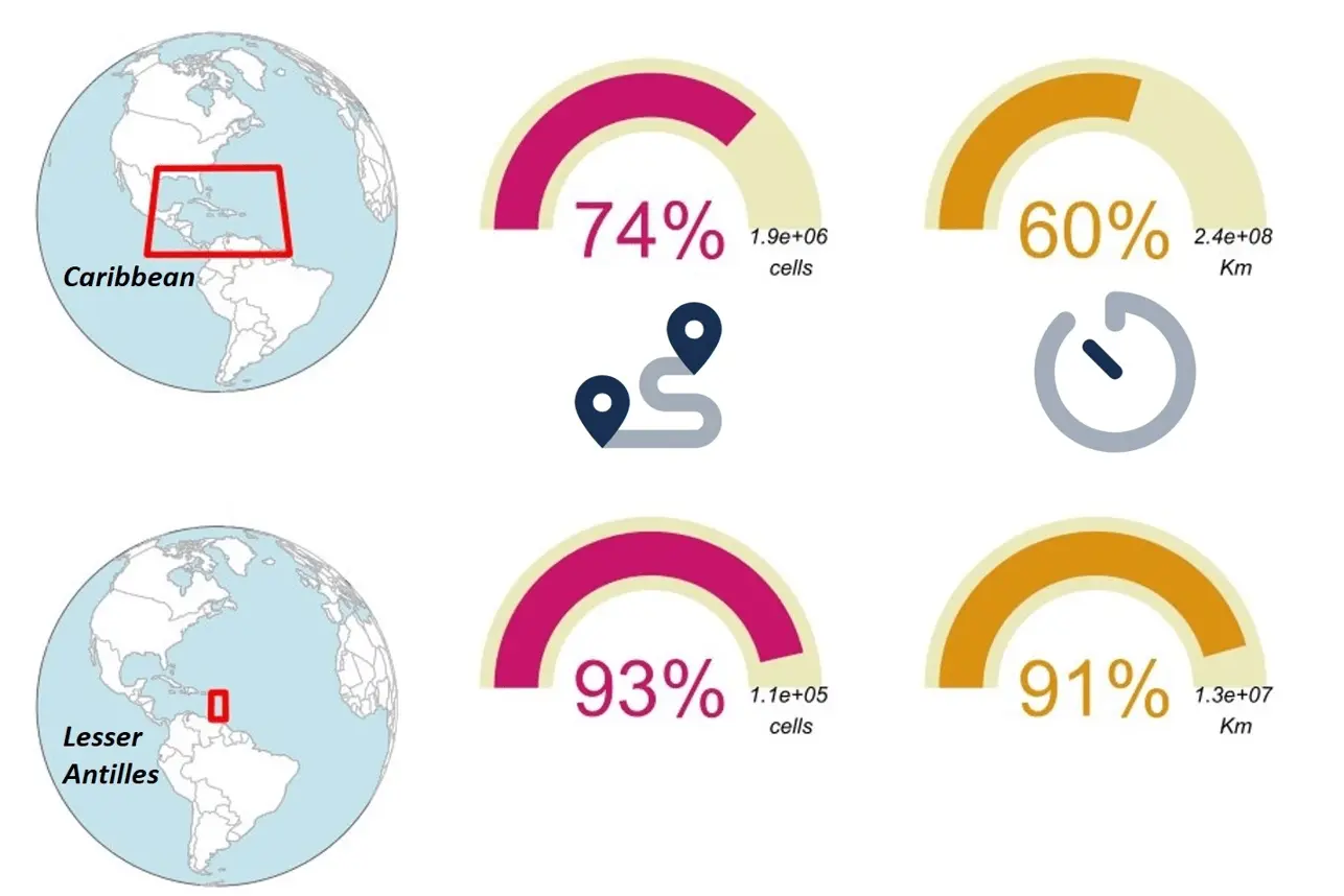
AIS LC
evaluation of the relative quality of AIS data from the European Maritime Security Agency (EMSA) in the Caribbean.
AMO FREBA
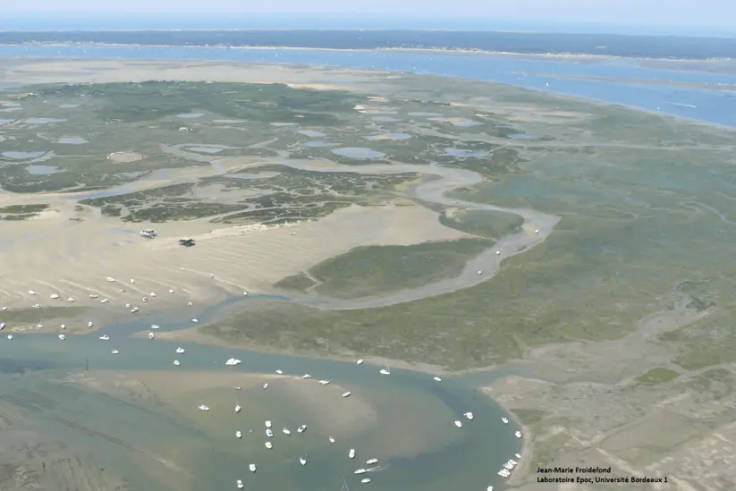
Project Management Assistance for the monitoring program of maritime uses in the Arcachon Basin
Our references
SHOM
France Energies Marines
Office français de la biodiversité
Groupe Artelia
OHM Littoral Caraïbe
Fondation de France
Labex DRIIHM
IUEM
UBO
ULCO
PNM du Bassin d’Arcachon
Sanctuaire Agoa
News
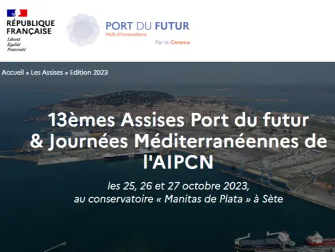
Port of the Future 2023 conference
We participated in the round table on “AIS, a strategic data for ports” during the Port of the Future 2023 conference in Sète.
Read more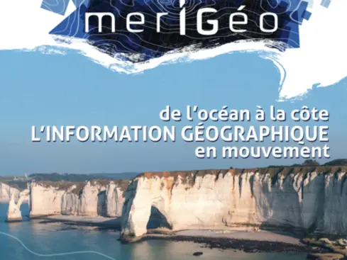
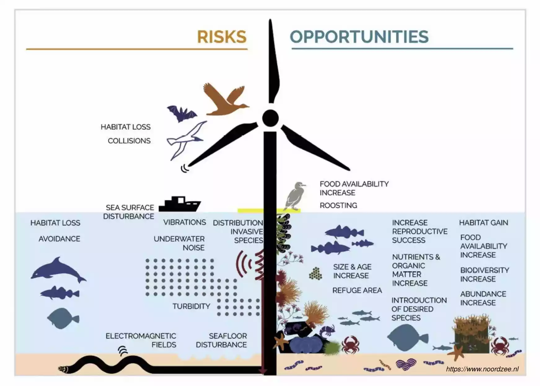
merIGéo 2023 Conference
We presented our work consisting in the identification of areas of less constraints (environmental and social) for the settlement of floating offshore wind farms via a spatial optimization approach.
Read more
A Geo4Seas map on the front page of the French National Center for Scientific Research (CNRS)
View the article online: https://www.
Read moreContact Us
Contact Details
You have specific expectations or are thinking about a project. Let us know your needs in terms of collaboration.
3 Venelle de la Tour d'Auvergne, 29480 Le Relecq-Kerhuon, France
Mobile: 06-64-42-67-93
Mél: damien.leguyader@geo4seas.com
CNRS