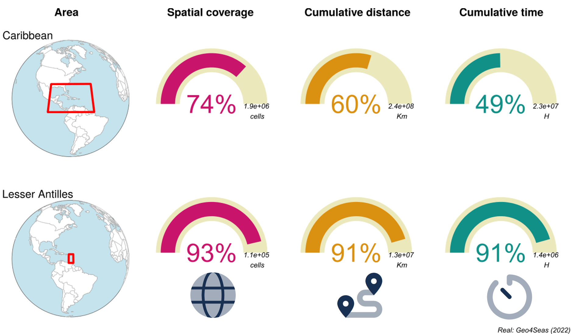
Evaluation of the relative quality of AIS data from the European Maritime Security Agency (EMSA) in the Caribbean
This project aimed to compare 2019 EMSA and exactEarth AIS datasets. It aimed to evaluate the consistency of an annual observations series on maritime traffic in the Lesser Antilles based on AIS data.
Geo4Seas contributed to this project by providing its expertise in geomatics specifically throught the analyses of AIS (Automatic Identification System) data.
This project was supported by the Human & Environmental Observatory “Littoral Caraïbe” in the framework of the call for research projects 2022 of the Labex DRIIHM (project No 2767).