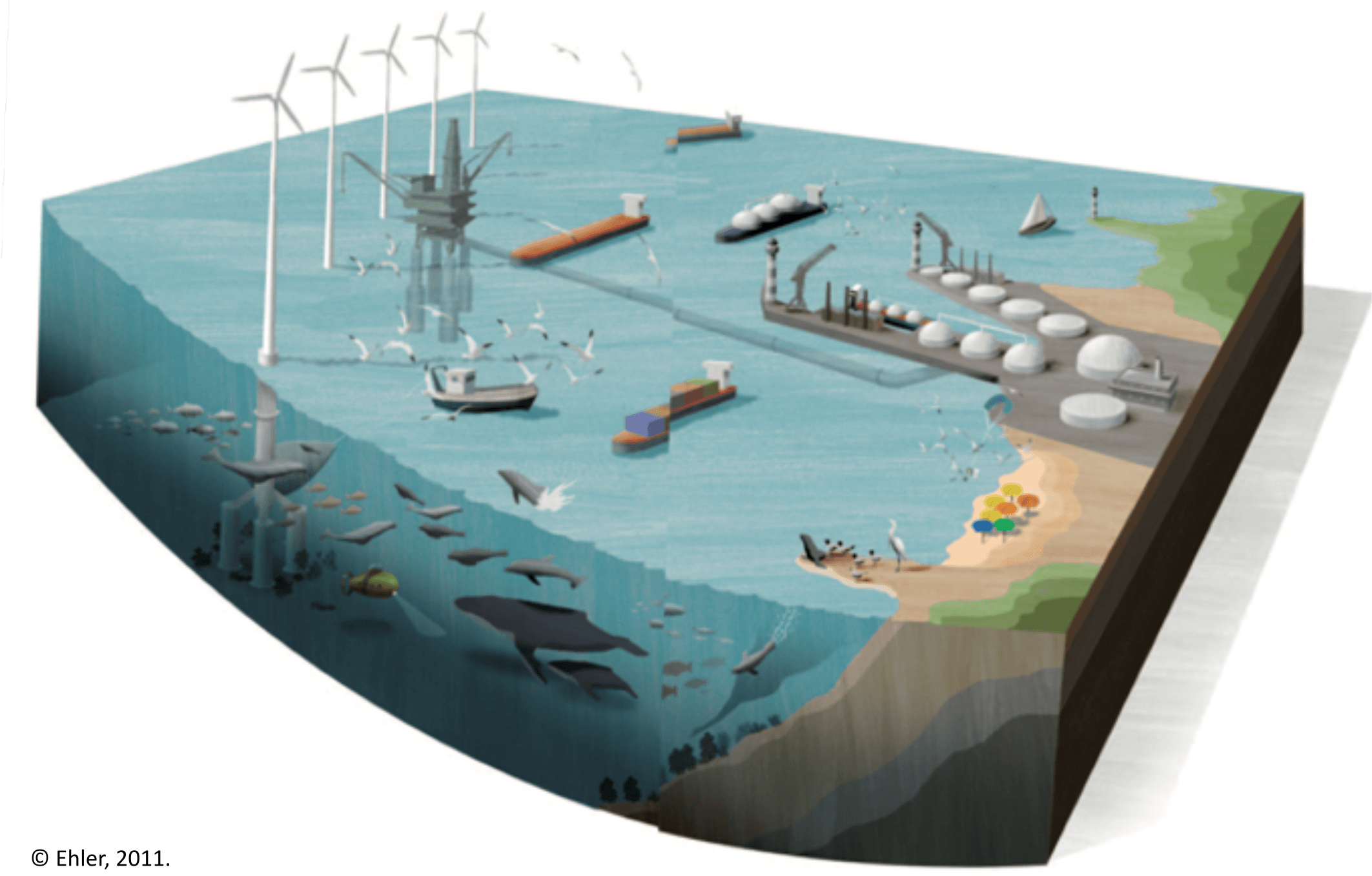
The multiple pressures on coastal resources and the need to harmonise the uses of the sea require an integrated approach to the planning and management of these areas.
The European Directive for Maritime Spatial Planning (MSP Directive 2014/89/EU) aims to contribute to an effective integrated management of maritime activities and the sustainable use of marine and coastal resources. To achieve this, it recommends that essential knowledge be available to describe the spatio-temporal description of maritime uses and the potentiel conflicting or synergistic interactions between activities.
Most often, the identification of potential interactions between different activities at sea is carried out by spatially superimposing the practice zone of each activity without taking into account the temporal dimension. Or, some activities may take place in the same place (or in part) but not at the same time.
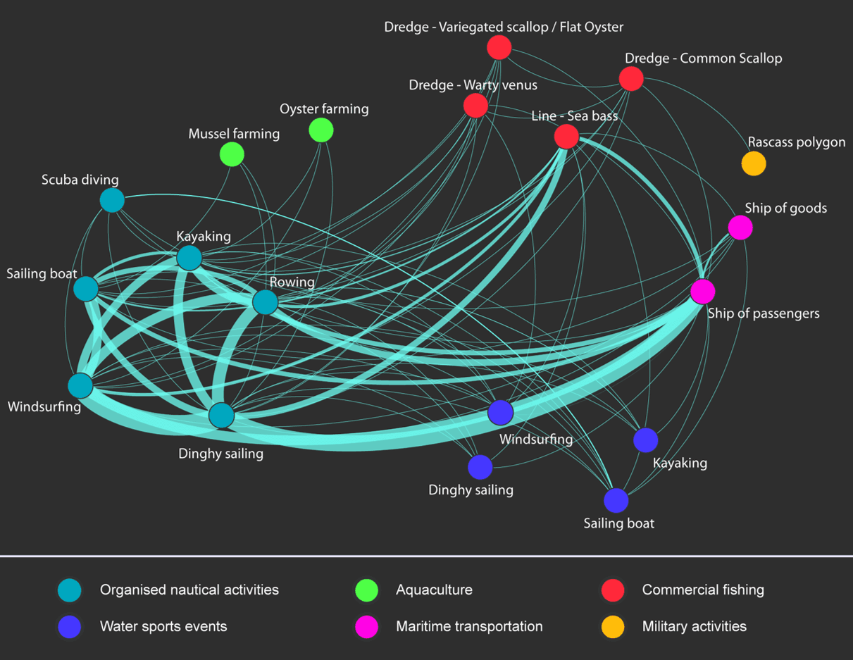
In order to identify spacel uses conflicts between activities by taking into account their temporal dynamics, Geo4Seas has developed a method to characterize spatio-temporal intersections (STI) between activities at high resolution (Le Guyader, 2012; Gourmelon et al., 2014).
This approach makes it possible to identify :
- which activities are concerned and to quantify it?
- when are the potentially sensitive periods?
- where are the areas of weakest and strongest potential interactions?
References
Le Guyader, D. (2012). Modélisation des activités humaines en mer côtière (Université de Bretagne occidentale). http://tel.archives-ouvertes.fr/tel-00717420
Gourmelon, F., Le Guyader, D., & Fontenelle, G. (2014). A Dynamic GIS as an Efficient Tool for Integrated Coastal Zone Management. ISPRS International Journal of Geo-Information, 3(2), 391‑407. doi: 10.3390/ijgi3020391