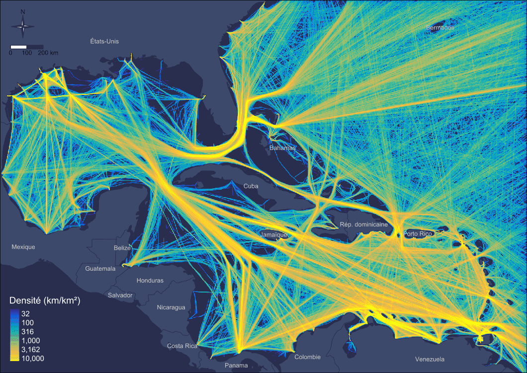
For more than 12 years, we have developed an expertise on the spatial and temporal characterization of maritime transport (tanker, cargo and passenger) using AIS data (Automatic Identification System).
The purpose of the AIS system is to support safe navigation. It allows real-time geolocation of transmitting vessels.
The analysis of archived AIS data covers a wide range of topics including transport engineering and management, maritime traffic, maritime economics, fisheries management, risk analyses, optimisation of vessel routes and the ecological impacts of maritime transport (measurement of noise emissions, measurement of pollutants, assessment of the risk of collision with cetaceans). More generally, AIS can contribute to the implementation of public policies, particularly in terms of planning.
Our methods, initially developed in a research framework, have been applied in various operational contexts. Mobilizing reliable and robust technologies, our strengths consist in providing various services (Le Guyader et al., 2012; Le Tixerant et al., 2017; Le Guyader, 2019) :
- Uses of satellite and terrestrial AIS data with global coverage
- Processing of raw data (NMEA format)
- Typological enrichment from external sources
- Analyses of large volumes of data
- High spatial and temporal resolution analyses
- Multi-scalar analysis
In connection with our R&D work, we can adapt the analyses to your specific needs (estimation of the anchor draging length for ships at anchor, identification of minimum approach distances to sensitive areas, etc.).
These services can be proposed for any other data describing the movement of mobile objects (GPS, Galileo, Argos type geolocation signals).
References
Le Guyader, D., Brosset, D., & Gourmelon, F. (2012). Exploitation de données AIS (Automatic Identification System) pour la cartographie du transport maritime. M@ppemonde, 104(2011.4), http–mappemonde.
Le Guyader, D., & Le Tixerant, M. (2019). De multiples applications pour l’analyse des données AIS (Automatic Identification System) et la géo-visualisation interactive de données. Responsabilité & environnement, 2019/02(94).
Le Tixerant, M., Le Guyader, D., Gourmelon, F., & Queffelec, B. (2018). How can Automatic Identification System (AIS) data be used for maritime spatial planning? Ocean & Coastal Management, 166, 18‑30. doi:10.1016/j.ocecoaman.2018.05.005